| NOgo Tour '00-'01 | Home | Route | Dispatches | Background | Links |
|
| ||
| re: Font Size Matters | date: Sept. 7, 2000 | location: Saskatchewan, Canada |
|
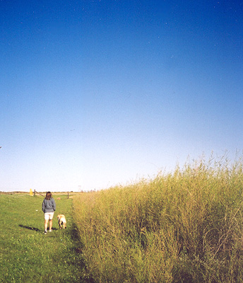
In the next year we are going to see a wide variety of landscape, but I don't think we will ever see as much variety in a single day as we did on September 6, the third day of our trip. We woke up in Lake Louise, 5000 feet in the mountains, spent the morning in Banff National Park, and by nightfall we were hundreds of miles into the flat prairie of southwestern Saskatchewan. As we left Banff, the valleys broadened slightly. Then, suddenly, we burst out of the mountains into gently rolling pasture land. One second we were surrounded in all directions by towering peaks, the next second we could only see them in our rearview mirror. For the 100 km to Calgary it felt as if we were driving through a giant living Wyeth painting, complete with hills of billowing wheat, rustic homesteads, and wispy clouds in blue sky. It didn't feel like we were losing altitude, just gently bobbing up and down. Within a few hours we reached Calgary. Without warning -- no suburbs, no meandering housing developments -- we went from empty pasture land to Calgary's Olympic Park and then into Calgary itself. Great travel writers are prone to making sweeping generalizations. Usually their statements contain a grain of truth, but like all biases they are applied too broadly and without consideration for individuality. For example, Paul Theroux will tell you that all Chinese people use laughter to communicate their displeasure or that all Pacific Islanders think Spam is a delicacy. Now, I don't consider myself much of a writer or much of a traveler, but let me borrow from their style and put forth the first of several unfair, overly-generalized statements on this web site. Canadians don't know how to build a damn interstate through a city! You're coasting along at 110 km/hour on a divided highway, you round a bend, and suddenly you're staring at the rear end of a car parked patiently at a red light. Their highways just come to an end on one side of a city and start up again on the other. You are left to find your way through a maze of Tim Horton's and strip malls, playing "Where's Waldo" with the microscopic Highway 1 signs they hide throughout the city every few miles, tucked cozily behind a convenient bush or tree. In the US we happily bulldoze a 1/2-mile-wide strip of concrete through the largest or smallest of towns, but not here! We finally emerged on the far side of Calgary (actually, it didn't take that long, I'm just being dramatic) and followed Highway 1 southeast. The land was more flat here, and the fields drier. Most of is was unfarmed. Perhaps it was grazing land, but for hours we didn't see man or beast or machines in the fields.
We both grew up in Minnesota so we are used to open farmland. There, as in most of North America, you find a friendly gas station, grain elevator, or cafe every few miles. You feel like you are in the country, but you know that civilization is standing quietly nearby. Let's just say that wasn't the case here in Southeast Alberta. The big eye-opener came when we tried to stop at Gleichen (10 point, no bold) and found nothing but a dusty, rusty gas station with a single pump. That was Gleichen. Who knows what 9-point Duchess was like, or -- God forbid -- 8 point Ralston. What in Seattle looked like a reassuring chain of pleasant small towns now looked a lot more like something out of one of those road movies that take place in Arizona. The guy stops for gas and . . . We made it to Medicine Hat, ready for a home-cooked meal at a local diner, and proceeded to spend the next 20 minutes driving around town looking for a restaurant. Believe me, it's hard to spend 20 minutes driving around a town that size. Five would be more appropriate. But we couldn't find a single restaurant. Not a one. Eventually we found a cowboy bar that served food, and I sat down to a buffalo burger and a plate of fries and gravy. (Sweeping generalization #2. Canadians love gravy on their fries.) By the end of dinner we were re-charged enough keep going. That, and the thought of spending the evening in Medicine Hat filled us with despair. We continued another 2 1/2 hours to Swift Current, Saskatchewan. This stretch was the most isolated of our entire drive. The two lane road twisted through gently rolling pastures. If we passed any towns they must have faded into the twilight because we certainly didn't see them. It was a beautiful drive. The horizon went on forever, and to our south we watched massive thunder clouds sliding across the plains. As I write this, we are angling down a long straight road, headed for North Dakota. We should hit the border in an hour or two. The drive this morning has brought us from Swift Current where we slept last night through Moose Jaw (a little slice of Lake Wobegon misplaced here in Canada) to our current location just south of Weyburn. It's been one of those drives where you're giddy with excitement when you encounter such natural wonders as a curve in the road or a slight dip in the landscape. The golden Wyeth hills are long gone, now replaced with piss-yellow tundra. You know things are grim when you eagerly count down the miles to North Dakota. But promising things await. Estevan is only 86 kilometers away, and it's 10-point bold! | ||
 Knowing that the next few days of driving would be through wide-open country, we tried to glean what we could from our road atlas. The 12-point bold font of the town of Medicine Hat looked promising. We set that as our first goal.
| More Dispatches |
| Copyright © 2001 Geoffrey Nelson | Send mail to: Geoff | Sarah |